
Input formats and coordinate reference systems
Source:vignettes/input-formats.Rmd
input-formats.RmdData frames and matrices use named or positional field selection. CSV files are read with base R. Existing columns and row order are retained.
classify_mesohabitat_table(hydromeso_example, 3, 4)## x y depth velocity mesohabitat_class mesohabitat
## 1 500000 4400000 0.200000 0.100000 1 Shallow Pool
## 2 500010 4400010 0.800000 0.100000 2 Medium Pool
## 3 500020 4400020 1.500000 0.100000 3 Deep Pool
## 4 500030 4400030 0.200000 0.400000 4 Slow Riffle
## 5 500040 4400040 0.200000 0.800000 5 Fast Riffle
## 6 500050 4400050 0.800000 0.400000 6 Raceway
## 7 500060 4400060 0.800000 0.800000 7 Faster than Raceway
## 8 500070 4400070 1.500000 0.800000 8 Faster than Deep Pool
## 9 500080 4400080 0.609999 0.299999 1 Shallow Pool
## 10 500090 4400090 0.610000 0.299999 2 Medium Pool
## 11 500100 4400100 1.369999 0.299999 2 Medium Pool
## 12 500110 4400110 1.370000 0.299999 3 Deep Pool
## 13 500120 4400120 0.200000 0.609999 4 Slow Riffle
## 14 500130 4400130 0.200000 0.610000 5 Fast Riffle
## 15 500140 4400140 0.800000 0.609999 6 Raceway
## 16 500150 4400150 0.800000 0.610000 7 Faster than Raceway
## 17 500160 4400160 NA 0.200000 NA <NA>
## 18 500170 4400170 0.000000 0.000000 1 Shallow PoolSpatVector objects and vector paths supported by
terra::vect() retain their geometry, CRS, feature order,
and attributes. This applies to points, lines, and polygons. GeoPackage
is preferable for examples; Shapefile export warns and uses short
class-field names.
v <- mesohabitat_example_vector()
classified_v <- classify_mesohabitat_vector(v, "depth", "velocity")
plot_mesohabitat(classified_v)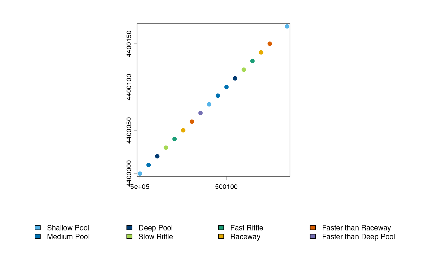
Rasters can be separate objects/paths or selected layers in one
multilayer raster. Geometry mismatches fail by default. With
align = "velocity_to_depth", velocity is projected or
resampled directly to the depth template with bilinear interpolation.
Missing CRS values are never silently assigned. assume_crs
assigns a declared CRS without transforming coordinates and reports that
distinction.
An AOI is projected to the raster CRS if necessary.
mask_aoi = TRUE performs both a crop and polygon mask;
FALSE performs only a rectangular crop.