
This example uses BlueTopo source tiles from the National Bathymetric Source catalog. The build verifies the downloaded assets and records their source metadata.
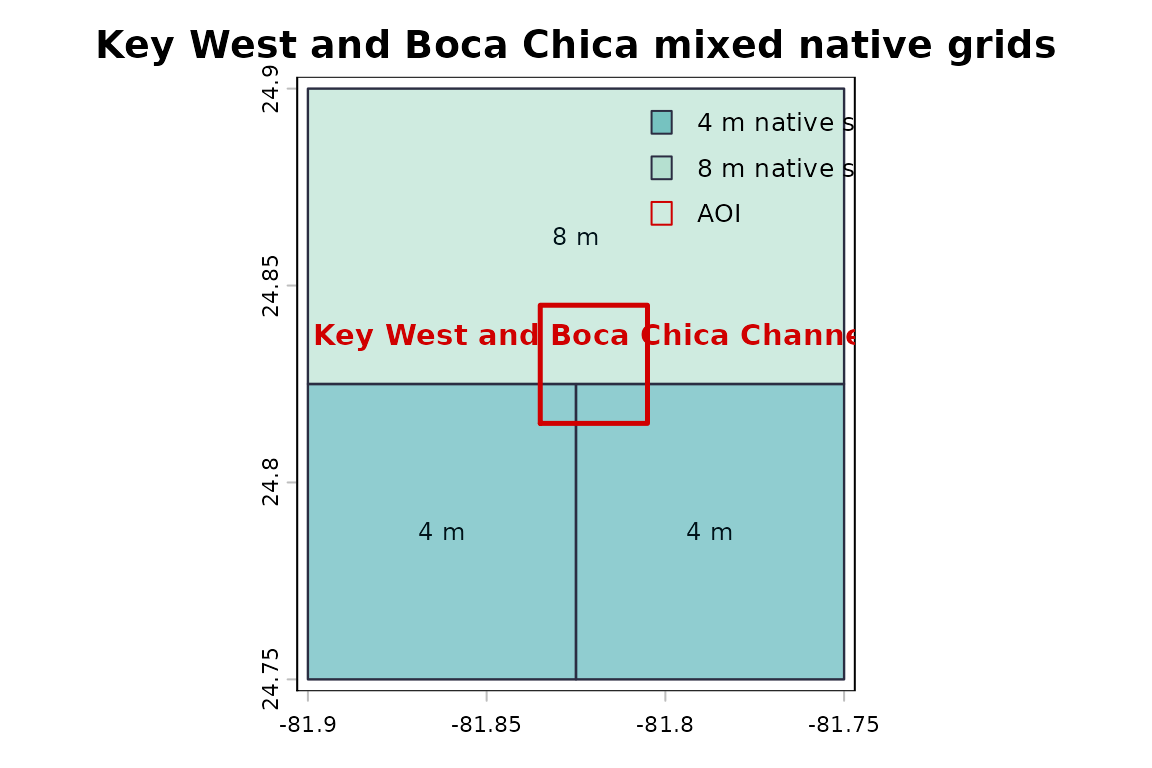
New York Harbor is the primary public AOI for the examples, but its current small plan is a compatible 4 m grid. This example uses BlueTopo tiles covering Key West and Boca Chica Channel because the documented secondary AOI currently intersects 4 m and 8 m source grids and therefore demonstrates mixed native-grid behavior.
Mixed native grids are preserved unless the user asks for a single
output grid. combine = "single" needs an explicit output
grid when native grids are incompatible. Resampled uncertainty values
are not original source cells, and contributor resampling must be
nearest-neighbor.
Native mixed-grid extraction
native <- bluertopo(
  real_aoi,
  resolution = "native",
  coverage = "fill",
  combine = "auto",
  details = TRUE,
  progress = FALSE,
  quiet = TRUE
)

if (!inherits(native$data, "SpatRasterCollection")) {
  stop("The documented real AOI no longer produces mixed native grids.", call. = FALSE)
}| Output object | Grid | CRS | Resolution | Source count | Layers |
|---|---|---|---|---|---|
| SpatRasterCollection | grid_01_epsg26917_4x4 | EPSG:26917 | 4 x 4 | 1 | elevation |
| SpatRasterCollection | grid_02_epsg26917_8x8 | EPSG:26917 | 8 x 8 | 1 | elevation |
Explicit single output grid
single <- suppressWarnings(bluertopo(
  real_aoi,
  layers = "elevation",
  resolution = "native",
  coverage = "fill",
  output_crs = "EPSG:26917",
  output_resolution = 100,
  combine = "single",
  details = TRUE,
  progress = FALSE,
  quiet = TRUE
))| Output object | CRS | Resolution | Extent | Resampled |
|---|---|---|---|---|
| SpatRaster | EPSG:26917 | 100 x 100 | 415613, 418713, 2744703.3, 2748003.3 | Yes |
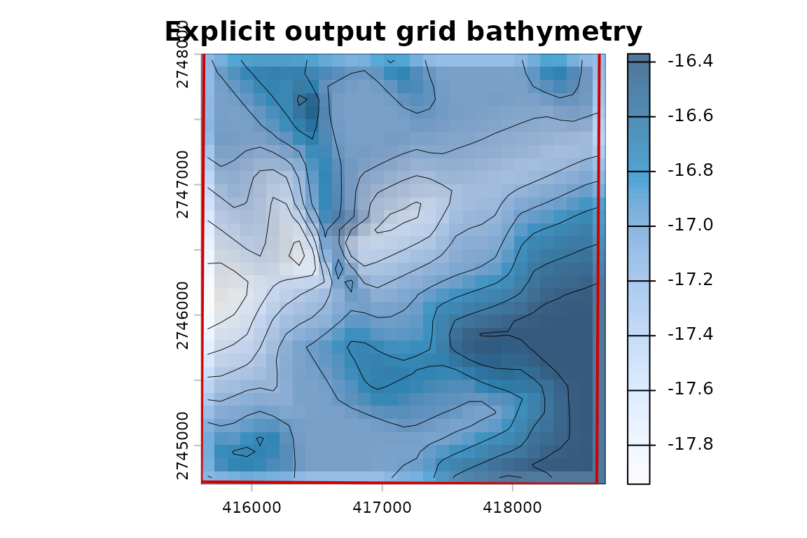
BlueTopo elevation resampled to the specified output grid.
The explicit grid is useful for workflows that require one raster, but it is a resampling operation. Native source-resolution selection remains separate from output-grid creation.